Developing the Blueprint Guideline for Dune-dike hybrid Nature-based-Solutions
Vicky Stratigaki, Nasrin Hassanpour and Joe El Rahi (Jan De Nul)
Tomas Sterckx and Marc Huygens (DEME Group)
Dries Bonte, Peter Troch (Ghent University)
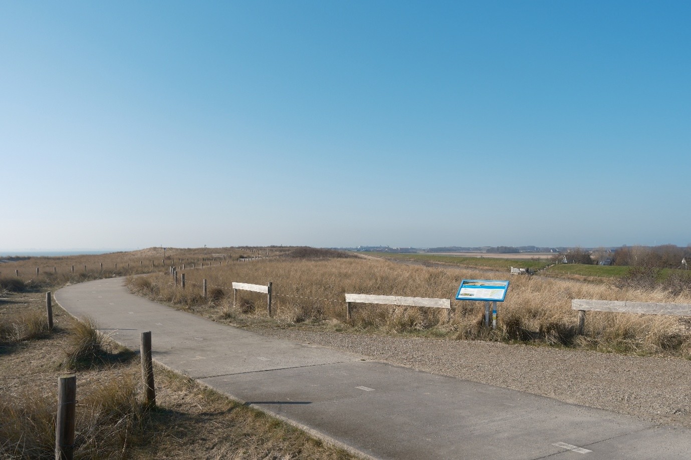
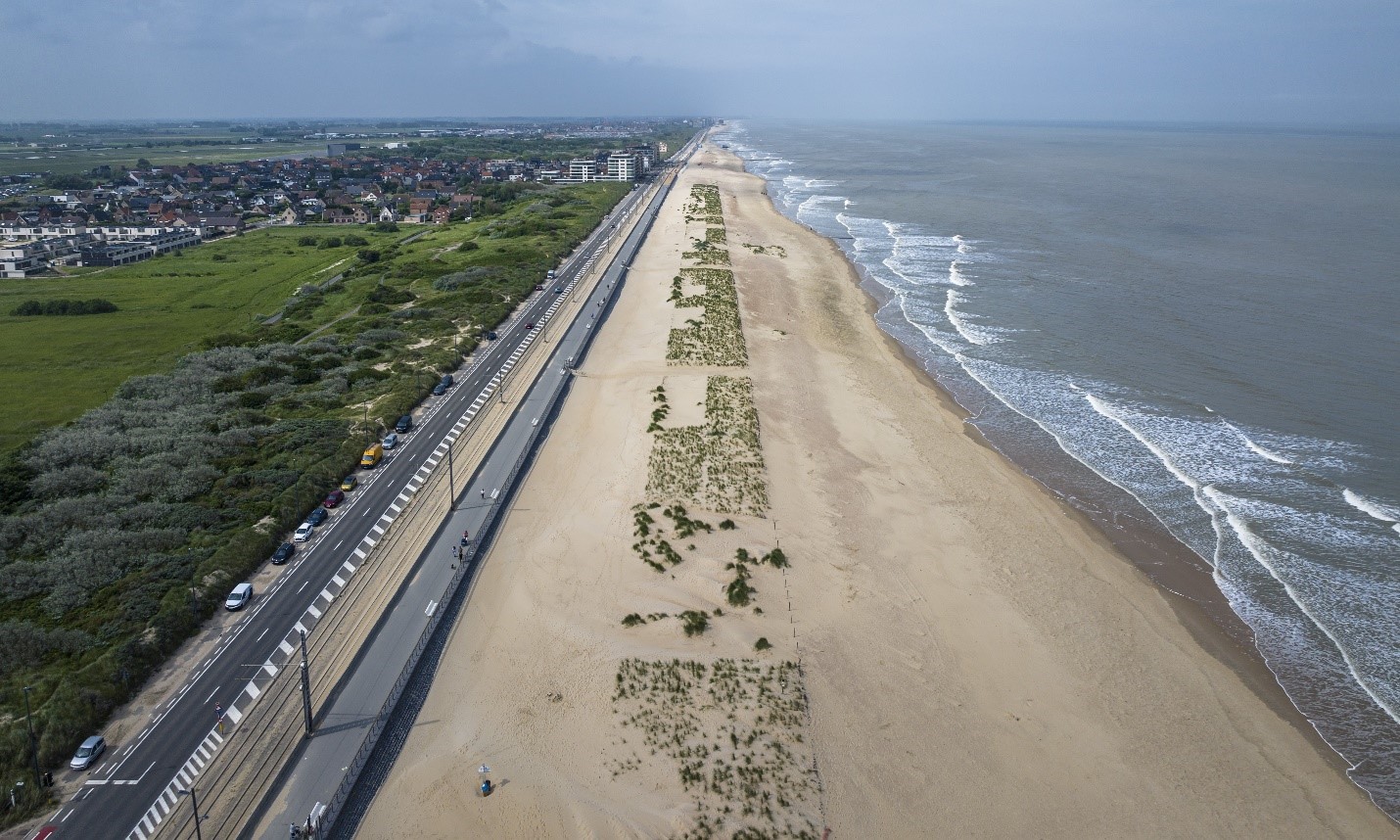
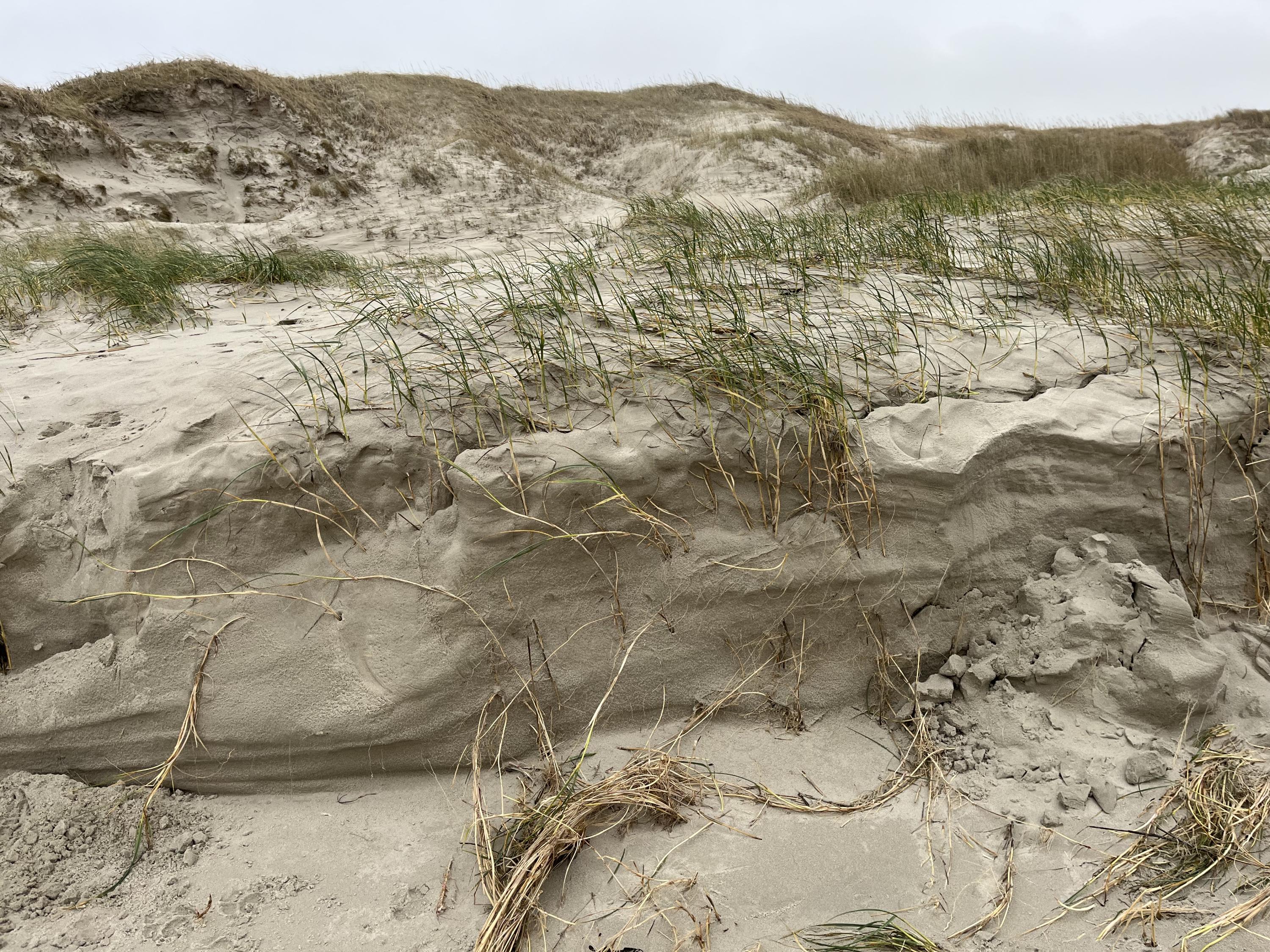
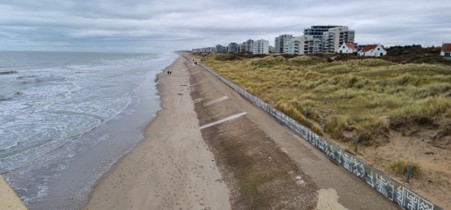
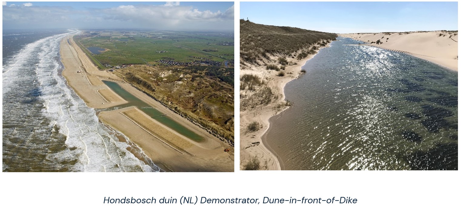
Dune–dike hybrid Nature-based-Solutions (DD-hybrid NbS) represent a new generation of coastal protection systems that integrate engineered safety structures with dynamic, biodiverse dune environments (Figure 1). As climate change accelerates sea level rise, intensifies storm regimes, and increases coastal erosion across Europe, the need for adaptive, multifunctional, and ecologically grounded coastal infrastructure has become urgent. While DD-hybrid NbS are increasingly recognised for their potential to enhance coastal resilience, biodiversity, and societal well-being, their large-scale implementation remains limited by fragmented knowledge, insufficient operational guidance, and a lack of integrated design frameworks that bridge engineering, ecology, socio-economics, financing, and policy. The DuneFront Blueprint addresses these gaps by establishing a guideline for the design, installation, and long-term management of these DD-hybrid NbS, while combining scientific research and industrial implementation insights.
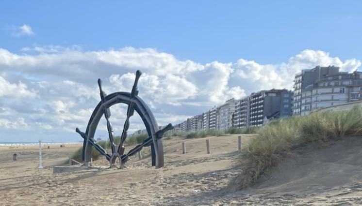
Figure 1. Example of Dune-Dike hybrid Nature-based-Solutions at Westende, Belgian Coast (Stratigaki et al., 2024)
The Blueprint provides a structured, step by step roadmap that supports practitioners, coastal managers, engineers, and policymakers throughout the full DD-hybrid project’s lifecycle—from early conception and feasibility assessment to implementation, monitoring, and adaptive management. It consolidates evidence from the 12 DuneFront Demonstrators, integrates insights from technical, ecological, and socio-economic work packages, and translates them into a practical, operationally grounded framework to ensure replicability and long-term impact of DD-hybrid projects.
Basically, the Blueprint is a recipe, providing a list of ingredients to compile a global guidance: while a Decision Support System first delivers the “why”; the Blueprint provides the “how to” once the decision has been made.
The Blueprint is built around five core pillars—Policy, Financing, Ecological, Technical and Social—which together reflect the multidimensional, holistic nature of DD-hybrid NbS. To translate this integrated framework into practice, the Blueprint defines nine sequential development steps spanning the full project life cycle and reflecting the core components of the Blueprint (see Figure 2). Reflecting both the integrated and adaptive character, identified steps are not to be explored in a fixed, consecutive order.
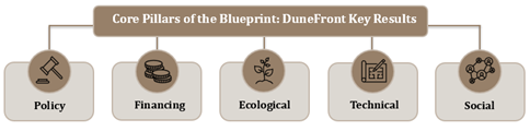
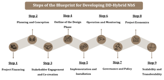
Figure 2. The Blueprint structure for DD-Hybrid NbS: five pillars and nine development steps
Additionally, within each pillar, the Blueprint identifies Key Target Indicators (KTIs) and associated parameters that shape system performance, constructability, ecological functioning, stakeholder acceptance, financial viability, and regulatory compliance. These KTIs provide a design-oriented complement to Key Performance Indicators (KPIs) by helping practitioners anticipate boundary conditions, compare design options, and support solutions that are robust, scalable, and aligned with local and regional objectives. Policy KTIs help identify relevant regulatory constraints, governance structures, and institutional responsibilities. Financial KTIs consider capital and operational expenditures, lifecycle costing, funding mechanisms, and the valuation of ecosystem services. Ecological KTIs ensure that hybrid systems are designed to support biodiversity, enhance ecosystem functioning, and maintain the natural processes that contribute to long‑term resilience. Technical KTIs ensure that hybrid systems meet safety requirements while maintaining compatibility with natural processes. Social KTIs help identify the needs, expectations, and concerns of stakeholders, ensuring that hybrid systems are co‑created with local communities and aligned with societal priorities. The defined KTIs do not prescribe specific design solutions; instead, they provide a systematic basis for assessing site conditions, identifying opportunities and constraints, and guiding the selection of appropriate interventions in a systematic, holistic and integrated way.
Based on respective research inputs of the demonstration sites and the operational practices and expertise of the industrial partners, the KTIs defined for each of the five Blueprint pillars for developing DD-hybrid NbS are summarized in Figure 3.
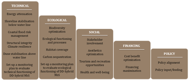
Figure 3. Key target indicators (KTIs) for each Blueprint pillar in DD-Hybrid NbS development
In conclusion, as Europe seeks to implement the objectives of the Green Deal, the Climate Adaptation Strategy, and biodiversity restoration initiatives, hybrid systems, such as Dune–dike hybrid Nature-based-Solutions (DD-hybrid NbS), offer a practical and scalable means of integrating nature dynamics and resilience into static coastal defence infrastructure. They demonstrate that coastal protection management can be achieved in ways that enhance, rather than degrade, ecological and social values. The Blueprint provides the guidance needed to realise this potential and to support the mainstreaming of nature‑based coastal protection across Europe. It establishes a scientifically grounded, operationally feasible, and context‑sensitive framework for the design and implementation of DD‑hybrid NbS - a recipe of ingredients, ready to be explored. It reflects the complexity and dynamism of hybrid systems while offering clear, structured guidance for practitioners.